How to get to Oxford
Oxford is not a campus university, so once you're here you can use our interactive, searchable map of Oxford's colleges, halls, departments, libraries and museums to find your way around or download our interactive and accessible Explore Oxford University Map. You can also use Google Maps to find your way around Oxford on foot or using public transport.
From London airports
From London Heathrow and Gatwick airports, take The Airline coach service, which runs 24 hours a day. You can also get to Oxford by train from Heathrow via London, and from Gatwick via Reading.
From London Stansted airport, take the Stansted Express train service to London Liverpool Street and then take the tube to either Paddington or Marylebone for direct trains to Oxford. Alternatively there is a National Express 737 coach service.
Trains
Direct services run from London Paddington (serving Oxford station) and London Marylebone (serving Oxford and Oxford Parkway stations). Other services operate from the north via Birmingham New Street; from the south via Reading; and from the west via Didcot or Reading.
For details and to plan your journey, see National Rail Enquiries.
Oxford Railway Station is a 5-10 minute walk from the centre of Oxford. Please use Google Maps or our interactive map to find your way from the station to the part of the University you are visiting.
Coaches
The Oxford Tube offers a direct service between Oxford and London, running a frequent timetable on a virtually 24-hour basis, Monday to Sunday.
For information on coaches from other major cities and airports, contact National Express.
The central coach station is at Gloucester Green in the city centre. Please use Google Maps or our interactive map to find your way from the station to the part of the University you are visiting.
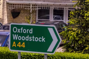
Parking in Oxford
Many Oxford streets are closed to traffic and parking is limited.
Taxis
There are taxi ranks at Oxford Railway Station, Gloucester Green Coach Station and St Giles' in the city centre.
Related documents
Can't find what you're looking for?
Try our extensive database of FAQs or submit your own question.


