Intensifying rainfall over South America revealed by new generation of climate model
Dr Marcia Zilli, Postdoctoral Research Assistant in Climate Dynamics, and Dr Neil Hart, UKRI Future Leaders Fellow, School of Geography and the Environment, explore the likelihood of increases in intense rainfall events alongside heatwaves in Brazil.
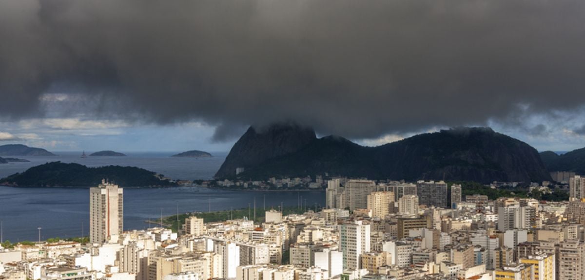
It has been a little over one year since the devastating floods in Rio Grande do Sul. While Brazil has been spared a second flood of the same unprecedented scale, extreme rainfall events continue to hit.
Our results show that while the frequency of all tropical-extratropical cloud bands will reduce by a third, the most intense rain events - those ranked as a one-in-five event in the present climate - triple in likelihood by the end of the century for the highest greenhouse gas emissions scenario.
For example, on 11th October 2024 the city of São Paulo was hit by an intense rain storm with winds over 100km/h leading to an electricity outage effecting more than two million people.
The outage lasted for 35 hours, but parts of the city remained without power for more than three days.
The economic losses ranged from damaged household appliances and spoiled food to hospitals having to discard large amounts of medication that must be kept under refrigeration. The business and entertainment sector also faced large losses, with the financial impact of what was already a catastrophic event multiplied by the fact that the outage happened over the weekend. In total, the economic losses are estimated in more than BRL 1.65 billion (equivalent to £200 million).
Our latest paper, ‘Threefold increase in most intense South Atlantic convergence zone events by 2100 in convection-permitting simulation’, produced in collaboration with Ron Kahana and Kate Halladay, senior researchers from the Met Office, investigates changes in the frequency and intensity of the weather system responsible for these severe storms under continued planetary warming.
In a typical Brazilian summer, large bands of cloud develop across South America spreading from the tropical Amazon forest southeastwards into the southern Ocean. These are called tropical-extratropical cloud bands and produce up to two-thirds of annual rainfall across much of southeast Brazil.
However, intensely raining clusters of thunderstorms are embedded within these cloud bands. It is these embedded rainstorms which create the natural disasters such as the São Paulo storm mentioned above and the massive landslides in Rio de Janeiro state that took place in January 2011, killing more than 200 people.
In our paper, we evaluated future climate projections based on a high-resolution state-of-art climate model. Traditional climate models, such as those used in the latest IPCC report, have a spatial resolution of about 100km (think of these as pixels which the model can simulate) - too large to correctly represent intensely raining clusters of thunderstorms.
The new generation of models have a much finer spatial resolution - 4.5km - resulting in a more realistic representation of the localised heavy rainfall clusters. This improvement happens because the physical equations governing thunderstorm development can be explicitly used by the model rather than the statistical approximations of thunderstorms used in traditional 100km resolution climate models.
Our results show that while the frequency of all tropical-extratropical cloud bands will reduce by a third, the most intense rain events - those ranked as a one-in-five event in the present climate - triple in likelihood by the end of the century for the highest greenhouse gas emissions scenario.
Crucially, this cloud band intensification rate is far higher than that estimated in typical climate models, suggesting that this future rainfall risk has been underestimated in previous work. These results imply a greater risk of flooding events as the planet continues to warm.
Furthermore, the reduced total frequency of cloud band events could result in both more frequent droughts and more frequent heat waves.
Focusing on drought-heatwave risks is the next step in our research. Our team has recently started a new project under the Climate Science for Services Partnership – Brazil, managed by the Met Office, to diagnose the climate processes driving recent droughts in the northern Amazon and unprecedented compound drought-heatwaves extended across the eastern Amazon down to the coastal cities of Sao Paulo and Rio de Janeiro.
This work is being done in close collaboration with Brazilian national forecast and disaster warning agencies to support their crucial efforts to enhance forewarning and preparedness, with the goal of avoiding the devastation caused by growing risks in which weather flips from heatwaves to floods and back again.
 25-year Oxford study finds the effects of conflict last for generations
 What Louise Thompson’s campaign tells us about the national maternity crisis
 Celebrating 25 Years of Clarendon
  Learning for peace: global governance education at Oxford
  What US intervention could mean for displaced Venezuelans
  Setting the agenda for the next century of quantum
 10 years on: The Oxford learning centre making an impact
 Mapping the Moon: the world’s first lunar atlas goes digital
  Oxford and The Brilliant Club: inspiring the next generation of scholars
 New course launched for the next generation of creative translators