Image credit: Shutterstock
Tracking endangered sea turtles with hardware the size of a pound coin
As part of their research project Amanda Matthes and Jonas Beuchert, supervised by Professor Alex Rogers, developed ‘SnapperGPS’, a low-cost, low-power wildlife tracking system based on satellite navigation. In summer 2021, they deployed it for the first time on wild animals: endangered loggerhead sea turtles in Cape Verde.
Location tracking devices are an important tool for biologists to study animal behaviour. Usually, they use global navigation satellite systems like the GPS for this. However, existing devices are often expensive and come with heavy batteries for long-term deployments. One tag can easily cost more than $1000, which prohibits studies with many animals. That is why SnapperGPS was developed.
Location tracking devices are an important tool for biologists to study animal behaviour.
The aim was to create a cheap, small, and low-power tracking solution. The core idea is to make the hardware simple and energy efficient by doing as little signal acquisition and processing on the device as possible.
Instead, they created a web service that processes the signals in the cloud. This allows them to build a bare-bone receiver for less than $30, which runs for more than ten years on a single coin cell.
The concept they employ is known as snapshot GNSS. Its advantage is that a few milliseconds of signal are enough to locate the receiver. With SnapperGPS they faced the particular challenge that the hardware records signals at a much lower resolution than existing receivers. To address this problem, they developed and implemented three alternative algorithmic approaches to location estimation from short low-quality satellite signal snapshots, which are all based on probabilistic models.
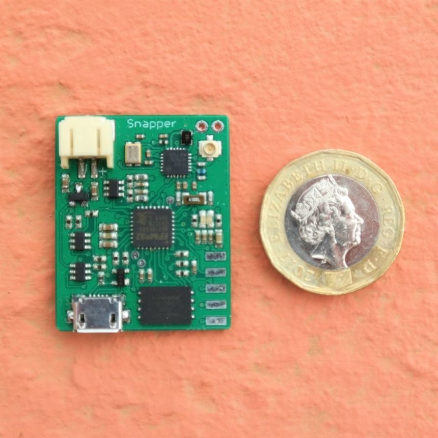 A SnapperGPS board next to a £1 coin. It measures only 3.5 cm x 2.8 cm.
Image credit: SnapperGPS team
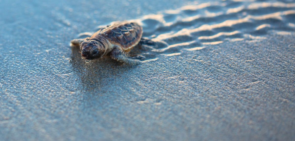
In summer 2021 SnapperGPS was deployed on nesting loggerhead sea turtles (Caretta caretta) on the island of Maio in Cape Verde.
Loggerhead sea turtles spend most of their life in the ocean, but every two to three years mature females come to a beach to nest. They lay several clutches of eggs separated by roughly two weeks, which makes it possible to recover the hardware and any data it captured.
Navigation satellite signals cannot travel through water, but sea turtles regularly come to the surface to breathe. These short windows of opportunity may not always be enough for traditional GPS methods to resolve the position of the receiver. But a snapshot method only requires milliseconds of the signal which makes them ideal for such marine applications.
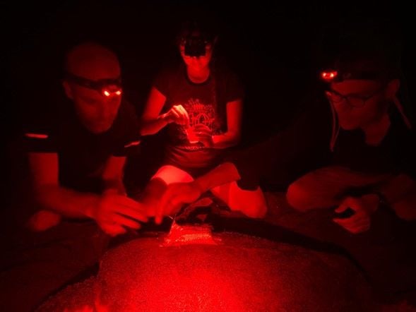
For this turtle deployment, the SnapperGPS tags were placed into custom-made enclosures that were tested to be waterproof to at least 100 m.
Due to the COVID-19 pandemic, they had to deploy the tags late in the nesting season which negatively affected our recovery rate as many turtles were already laying their last nest when they were tagged.
In total twenty tags were deployed and nine recovered. Some experienced unexpected technical failures but the tags that survived were able to capture several location tracks that showed unexpectedly diverse behaviour among turtles.
Wildlife location tracking data can inform conservation policy decisions that help protect habitats and prevent human-wildlife conflicts.
This data provides novel insights into the loggerhead sea turtle population on Maio. The exercise also taught the team important lessons about the specific challenges of deploying SnapperGPS on a sea turtle and they are working on an improved version for next year’s nesting season.
Wildlife location tracking data can inform conservation policy decisions that help protect habitats and prevent human-wildlife conflicts. In the case of loggerhead sea turtles, understanding their movements can inform where to direct anti-poaching measures and it can identify important marine habitats that may need special protection.
SnapperGPS is supported by an EPSRC IAA Technology Fund. Additionally, Amanda and Jonas receive support from the EPSRC Centre for Doctoral Training in Autonomous Intelligent Machines and Systems (AIMS CDT). The field work was made possible through a cooperation with the Maio Biodiversity Foundation and the Arribada Initiative.
 SnapperGPS team has tracked to a location of a loggerhead sea turtle captured by a SnapperGPS tag.
 Image credit: SnapperGPS team
 From research to action: How the Young Lives project is helping to protect girls from child marriage
  Can we truly align AI with human values? - Q&A with Brian Christian
  Entering the quantum era
 Can AI be a force for inclusion?
 AI, automation in the home and its impact on women
 Inside an Oxford tutorial at the Museum of Natural History
  Oxford spinout Brainomix is revolutionising stroke care through AI
 Oxford’s first Astrophoria Foundation Year students share their experiences
 DPhil student, Frankco Harris, reflects on his unique journey to Oxford and future plans
 Oxford undergraduates reflect on their first term